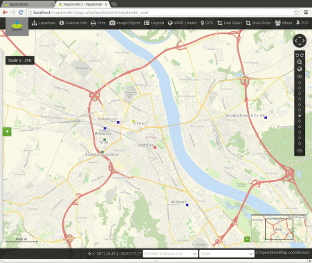
The open source software Mapbender is a contentmanagement system for geospatial data services and mapapplications. With Mapbender you can create applicationswithout writing a single line of code. Based onstate-of-the-art technologies Mapbender is a flexible clientfor OGC services. The software is an OSGeo Project andlicenced under MIT.
What does Mapbender offer?
High user-friendliness
- Modern web-based interfaces for user andadministrators
- Delivery with preconfigured applications for displaying,navigating and querying maps (OGC Services)
- Administration of OGC Services in a Service repository.Individual configuration of Services in every application
- Customization of applications to individualrequirements via the web interface with a collection of customizable elements
- The adaption of the designs can be done via customizable templates and CSS
- Based on the integrated user management, individual applications, single functionality and services can be assigned to specific users or groups
- Copy, import and export of applications
Feature
- Mapbender has its own template for mobile applications, which has been optimized for use onsmartphones and tablets
- Digitalization: Mapbender makes it possible to create,retrieve and change geometry objects in the web browser. Complex forms for data input can be generated. All is configured via the administration Data source is SQL
- Search: Configurable modules for creating searches via SQL or Solr
- Web-based printing with customizable print templates and image export
- WMC creation and handling
- GPS positioning
- And more nice features to discover
You can extend Mapbender with your own modules and additional functionality.


